Every post card in my collection has its own story. Every Wednesday I post one of the 3,000 plus stories.
Showing posts with label Southern Pacific Railroad. Show all posts
Wednesday, March 12, 2025
Welcome to Tucson
The picture on the front of this post card is not of a locomotive. I know. I am shocked, too!! However, it is the next post card in line in my collection to be featured here, so here we go...
Our friends at Wikipedia say this about the station:
The depot was built in 1907 by the Southern Pacific Railroad (SP). It was designed by the SP's architect, Daniel J. Patterson, who designed a number of depots during the same era, including the San Antonio Station.
In 1889, Patterson moved to San Francisco to establish a practice there. His work caught the attention of the Southern Pacific Railroad (SP), which had its headquarters in San Francisco. They had him design a number of their stations and other facilities, many of which survive. Among these were the San Antonio Station, Berkeley Station (1906), the Salt Lake City Union Station, the Tucson Station, and the Willits depot. He was also the architect for the Union Station (1911) in Seattle, Washington. He designed three of the SP's hospitals, in San Francisco, El Paso, and Houston, as well as many of the railroad's industrial structures, such as electrical sub-stations and the Alameda Shops.
This website gives us a bit more detail about the history of the station - and its prececessor:
https://www.greatamericanstations.com/stations/tucson-az-tus/
The Tucson depot is today the pride of downtown. Originally designed in 1907 by Southern Pacific Railway (SP) staff architect Daniel Patterson and staff engineer J.D. Wallace, the original brick structure was in the Spanish Revival style then so popular throughout the southwest. The building, costing $665,000, featured a center portion with a hipped red tile roof flanked by two end towers that framed the entire composition. The windows of each tower displayed elaborate ornamentation in the Churrigueresque style, marked by expressive, sculptural detailing generally associated with Spanish architecture of the 17th and 18th centuries. A circular drive allowed visitors to pull up to the front entrance to pick up and drop off friends and family who could linger underneath the shade of the front arcade.
Although quite beautiful and impressive, the 1907 depot was actually the second on the site. When the Southern Pacific Railroad arrived from Yuma in 1880, the company built a wooden station with deep eaves and windows featuring colorful awnings; President McKinley stopped here in 1900. This building was replaced because passenger and freight traffic outgrew the space.
The 1907 station complex was sold to the city of Tucson in 1998 by the Union Pacific Railroad for $2.1 million dollars.
The post card was published by the Detroit Publishing Company. It was printed using what they called the "Phostint" method. After negotiations with Orell Fussli, Detroit became the sole American company to license the Swiss photochrom process, which they would eventually register in 1907 under the name Phostint.
Wednesday, September 7, 2022
Going Home after Coming Home
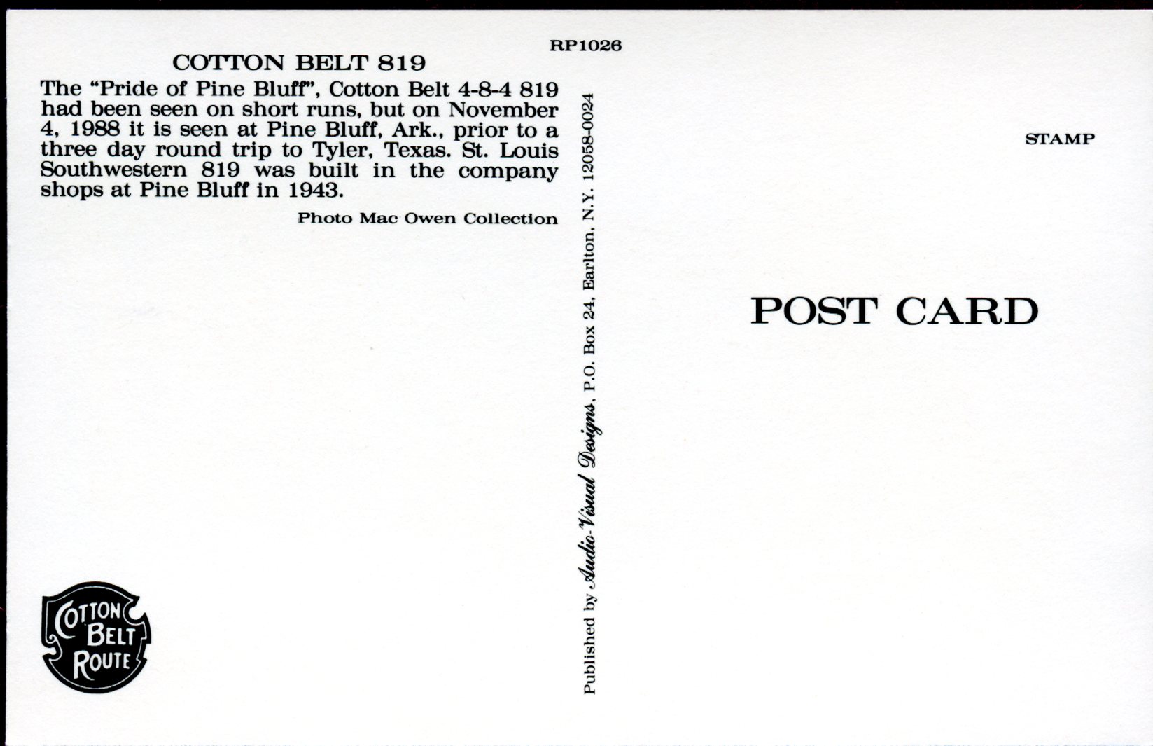
The locomotive shown here is a 4-8-4 Northern class engine, the “Pride of Pine Bluff”. In fact, it is in Pine Bluff, Arkansas on November 4, 1988 in this picture, prior to a three day round trip to Tyler Texas. This locomotive #819 was built in the shops here in Pine Bluff. It is coming home, so to speak, as it gets ready to go to the home of the Cotton Belt, Tyler, Texas.
Our good friends at Wikipedia tell us this: The St. Louis Southwestern Railway Company (reporting mark SSW), known by its nickname of "The Cotton Belt Route" or simply "Cotton Belt", is a former US Class I railroad which operated between St. Louis, Missouri, and various points in the states of Arkansas, Tennessee, Louisiana, and Texas from 1891 to 1980. In 1980 the Cotton Belt began operating the Rock Island's Golden State Route which added the states of Kansas, Oklahoma, and New Mexico to the operation. It operated as a Southern Pacific subsidiary from 1932 until the operation of the Cotton Belt was assumed by Southern Pacific Transportation Company in 1992.
What follows here is the history of the beginning and the end of the Cotton Belt Route with a list of all the railroads that have somehow been involved in the building of the railroad in between the beginning and the end. This history is taken from this website:
https://arkansasrailroadmuseum.org/about/cotton-belt-route.html#ewpopup/7/
Tyler Tap Railroad This was the first link in the St. Louis Southwestern Railroad (STLSW) Railroad in 1877 near Tyler Texas. The people of Tyler had hopes of being located on the main line of the International & Great Northern Railroad, but as it was surveyed to Longview by the way of Troup, the citizens decided to promote and construct a railroad to tap either the Texas & Pacific or the International. In charge of this scheme was a young army officer, Major James Postell Douglas. Upon returning home to East Texas after the War Between the States, Major Douglas became interested in the fruit industry. Needing a means of rapidly shipping this commodity outside the production area, he petitioned the Twelfth Legislature of Texas in 1870 to pass a special act of incorporation granting to him and others the right to locate, construct, own, operate, and maintain a railroad. It would own a single or double track for a distance not exceeding 40 miles from Tyler to connect with some other railroad, to be selected by the directors. His request was granted on December 1, 1871. This was a narrow-gauge line of 3 feet and operated with one small locomotive.
These railroads became part of the Cotton Belt over time: Texas & St. Louis Railway; St. Louis, Arkansas & Texas Railway; Little Rock and Shreveport Branches
Short Line Railroads Absorbed by Cotton Belt.
Little River Valley & Arkansas Railroad (Purchased 1881); Kansas & Gulf Short Line/Tyler; outheastern Railroads (Purchased 1899); Stuttgart & Arkansas River Railroad (Purchased 1901); Texas & Louisiana Railroad (Purchased 1903); Eastern Texas Railroad (Purchased 1906); Central Arkansas & Eastern Railroad (Leased 1910); Stephenville North & South Texas Railroad (Leased 1910); Paragould Southeastern Railroad (Purchased 1914); Pine Bluff Arkansas River Railroad (Leased 1918); The St. Francis Basin Project (1929-1930); Gideon & North Island Railroad; Deering Southwestern Railroad; Blytheville, Leachville & Arkansas Southern Railroad; Manila & Southwestern Railroad; Cairo, Truman & Southern Railroad; Arkansas Short Line Railroad; St. Louis Southwestern Railway
Southern Pacific Takes Control Since 1919 the Cotton Belt had been a very important connection of the Southern Pacific system on traffic between points in the East and the Pacific Coast and points in Texas. The consolidation and strengthening of other systems in the Southwest during the decade, 1920-1930, brought the Southern Pacific to a realization that self preservation required a route to this competitive territory. In July, 1930, the Southern Pacific filed an application with the Interstate Commerce Commission seeking authority to acquire control of the Cotton Belt. The final order of the ICC approved the plan upon conditions which the Southern Pacific accepted in February, 1932. On April 14, 1932, the Southern Pacific Company purchased the stocks which had been in escrow, and on April 19, the same year, it issued sufficient amounts of its own stock to exchange for deposited St. Louis Southwestern stocks in order to complete its control of the Cotton Belt. By May, 1933, the Southern Pacific had 193,134 shares of St. Louis Southwestern preferred and 130,834 shares of St. Louis Southwestern common or 87.37 per cent of the total outstanding shares of Cotton Belt stock. This is another of my Audio Visual Designs post cards. That is the Cotton Belt logo in the bottom left-hand corner of the post card.
Wednesday, July 13, 2022
Way, Way Up There!!!
The train on the front of this post card is crossing the Pecos River near where it meets the Rio Grande River in Texas. The train and railroad was originally owned by the Texas & New Orleans Railroad. This railroad, along with many of its own subidiaries, eventually became part of the Southern Pacific Railroad System. The following information was gleaned from a couple of sites on Wikipedia. The Texas and New Orleans Railroad was chartered as the Sabine and Galveston Bay Railroad and Lumber Company in 1856, and was formed to build a railroad from Madison (now Orange) in Orange County to tidewater at Galveston Bay. Ground breaking was on August 27, 1857 outside Houston and real construction work began in April, 1858. In late 1876 the railroad’ gauge was converted from 5 ft 6 in to standard gauge. In 1878 the Texas and New Orleans, Charles Morgan's Louisiana and Texas Railroad and Steamship Company, and the Louisiana Western Railroad Company reached an agreement and the line was finished from Orange to New Orleans. The Louisiana Western Extension Railroad Company was chartered in Texas to build from Orange to the Louisiana boundary and the first through train ran from Houston to New Orleans on August 30, 1880. 1881 C. P. Huntington, acting for the Southern Pacific Railroad Company, bought the Texas and New Orleans as well as many other railroads in the southern United States. As a result of this acquiring of railroads by Southern Pacific, The Texas and New Orleans Railroad found itself as part of a major transcontinental route. In 1882, The T&NO made over $1,500,000 and owned 36 locomotives as well as over 1000 pieces of rolling stock. Also in 1882 the T&NO acquired the 103-mile (166 km) Sabine and East Texas Railway Company. Many more companies were merged into T&NO from 1880 to 1900. In 1934 all of the railroads that the T&NO was leasing were merged into T&NO, making it the largest Texas railroad with 3,713 miles (5,975 km) of road (not all in Texas). On November 1, 1961 the remaining 3,385 miles (5,448 km) merged into the Southern Pacific and the T&NO ceased to exist.
Trains on the Sunset Route of the Southern Pacific lines have crossed the Pecos River on three different bridges, completed in 1883, 1892, and 1944. The most famous was the 1892 Pecos High Bridge, for many years the highest railroad bridge in North America. On the original Sunset Route, completed in 1883, a low bridge was located at the mouth of the Pecos River, where it joins the Rio Grande. To reach this crossing, trains between Comstock and Langtry had to follow a winding route called the Loop Line, which descended southward down steep grades into the canyons of the Rio Grande, passed through two tunnels and deep cuts, and ran along ledges where the danger of rock slides was constant. In 1892 the Pecos crossing was moved northward five miles upstream from the junction with the Rio Grande, in order to eliminate the Loop Line and shorten the rail distance between San Antonio and El Paso by eleven miles. The new line reached the Pecos at a point where the river flows through a deep gorge. The Pecos High Bridge was built there in only eighty-seven working days, between November 3, 1891, and February 20, 1892. Some colorful legends of Judge Roy Bean date from these days, when he served as coroner after construction accidents. The first train to cross the bridge was a special carrying C. P. Huntington, president of the Southern Pacific, on March 30, 1892.
The 1892 high bridge was built by the Phoenix Bridge Company of Phoenixville, Pennsylvania, and was of the metal viaduct style with cantilever center sections. It was supported by twenty-four towers and had a total length of 2,180 feet. The rails stood 321 feet above the river. The bridge was thus the highest railroad bridge in North America and the third highest in the world (exceeded only by the 401-foot Garabit Viaduct in France, built in 1884, and the 336-foot Loa Viaduct in Bolivia, built in 1889). For many years it was a tradition for trains to pause near the bridge and proceed slowly so that passengers could view the canyon, the landmark bridge, and the river below. In 1909 and 1910 the structure was significantly reinforced, the original four-leg central towers were converted to six-leg towers, and the length was reduced to 1,516 feet by a filled embankment at the west end. Additional reinforcement was added in 1929. Finally, with the increased rail traffic during World War II, it became clear that a new, heavier structure was needed.
Construction was begun in August 1943 at a site 440 feet downstream from the 1892 bridge. The 1892 bridge was dismantled in 1949, with sections sold to highway departments and local governments in several states. The back of the post card tells us that part of the bridge is used to cross the Wabash River in the state of Indiana. The post card as rounded corners; not very many of the post cards in my collection do. It was published by Kustom Quality out of El Paso, Texas. I know it was published after 1963 because there is a zip code included in the company's address. It is still in existence today, although they don't have a website.
Wednesday, March 9, 2022
Let's Go to Mohler
Today, there is a railroad that runs from the Oregon coast to Portland. The predecessor to the Port of Tillamook Bay Railroad was a line built by the Pacific Railway and Navigation Company between 1906 and 1911. The line, whose reporting mark was "PR&N", was sometimes known as the "Punk, Rotten, and Nasty" because of the wet and muddy working conditions for crews building the railroad through the Coast Range. The line became the Tillamook Branch Line of the Southern Pacific Railroad in 1916. The above information was taken from Wikipedia. That is everything that I could find out about the tracks on which the train on the front of this post card is travelling. The title on the card says that it is near Mohler. I found out why some people would want to live in that area. I include it below. The first tidbit of information is from this website: http://www.smalltownoregon.com/01northcoast/mohler.html
If you want to take a nature drive from the coast back to Portland take Highway 53 eastbound off Highway 101 at the Nehalem junction just north of Wheeler. Better take your Dramimine before you start. You will quickly come to Mohler, the last settlement until you reach Highway 26 at the Necanicum junction. We just about dismissed Mohler on the day we passed through, but the place had a winery and that caught our attention. The next thing you know they will have a Starbucks! As you can see from my pictures we took only a few. Needing some filler for my page I did some research and I am pleased that I did. The Mohler family in America dates back to the 1700's. The family icon made his first money producing wheelbarrows for the gold rush in California. After the rush died down he returned to the mid-west to continue his career as an industrialist and eventually developed the Studebaker automobile! The story is amazing and the Mohler family keeps a nice picture web site of the whole thing!
This is more information about area as taken from this website: https://oregonwild.org/waters/protecting-oregons-waterways/nehalem-state-scenic-waterway
The Nehalem River is one of the most impressive waterways in the Oregon Coast Range Mountains. It is one of Oregon's longest free-flowing (ie undammed) rivers. It has outstanding wildlife, recreational, and scenic values that make it a great place to visit, or call home. After a two year vetting process the Oregon State Parks and Water Resources Commissions both unanimously recommended the river be designated as a "State Scenic Waterway" by Governor Brown, which she signed in 2019. This designation will protect the river corridor, recreational opportunities, wildlife, private property rights, and scenic values.
The post card was printed by the Pacific Novelty Company with branches in both San Francisco and Los Angeles. This publishing company printed many postcards that were duplicates of postcards published by Edward Mitchell. Mitchell was a partner with other photographers in this publishing company; then, at some point, he bought the others out. A major publisher and printer of view-cards depicting California in halftone lithography. They produced cards in different styles, most of which were printed in Germany. They eventually sold off their own printing department to Herman Vogel who renamed it Quadricolor Press. Pacific Novelty went on to produce photochromes that were manufactured in the United States. They existed from 1908 to the 1960s.
Wednesday, March 2, 2022
The Final Leg
The train on the front of this post card is peeking out of one of the human-made wonders of Southern California. The wonder is the tunnel that made the final connection of the Southern Pacific Railroad possible, the San Fernando Tunnel. Below is some history that explains the significance of the building of the tunnel. Its title is “1876: Southern Pacific Tunnels Through”. It was written by Alan Pollack, M.D. president of the Santa Clarita Valley Historical Society, and was found on this website: https://scvhistory.com/scvhistory/pollack0710tunnel.html
Work began on the San Fernando Railroad Tunnel on March 22, 1875. Former Central Pacific Railroad worker Frank Frates was chosen to supervise some 1,000 Chinese and 500 white laborers in constructing the tunnel.
Frates and his workers faced a sandstone mountain saturated with water and oil, causing frequent cave-ins and loss of life. According to Marie Harrington in her 1976 pamphlet titled "A Golden Spike":
"Frates' excavation was 22 feet high, 16½ feet wide at the bottom and over 18 feet at the shoulders, an angular arch being formed overhead. The Chinese worked as teams of two, one man holding the wedge in place against the rock while his partner swung the heavy sledge. The upper half of the tunnel was dug in advance of the bottom half for a distance of about 20 feet. Temporary timbers were placed as soon as the excavations were made; permanent timbers of Oregon cedar would be placed later. The lower half of the tunnel was dug by another crew of workers, the dirt being carried away by two-horse cars running on laid track. Day and night the work went on in 8-hour shifts, the Chinese being paid $1.00 per day and the white carpenters and mechanics receiving $2.60 a day for a 12-hour shift. A city of tents was located near the south end of the tunnel mouth for the workers."
Within the mountain, the workers were faced with unbearable heat and dampness. Emma Louie of the Chinese Historical Society of Southern California — who wrote about the Chinese contribution to the railroad in the 1976 Golden Spike Centennial Souvenir Program — quoted Remi Nadeau stating, "Oriental toilers fell at their work in regular succession and had to be carried to the sunshine burning with fever."
Originally estimated to take two years to complete, work was begun at both the north and south ends of the tunnel. To help expedite the enormous task, surveyors determined a spot at the summit of the mountain from which a vertical shaft was dug to meet with the center of the tunnel. This allowed waste rock to be hauled out of the tunnel by means of a large cable drum and hoisting engine built in Sacramento.
The tunnel actually took just over a year to complete. Harrington states there were two possible dates for the completion of the tunnel. The first version has Chinese diggers coming face to face July 14, 1876, with the opening of the tunnel just one-half inch out of line. Another version has Frates himself completing the tunnel in August 1876, removing the last cart of earth with his own hands.
At any rate, the first train passed through this miraculous, 6,966.5-foot tunnel August 12, 1876. At the time of completion, it was the third longest tunnel in the United States and fourth longest in the world.
The courageous work done on the San Fernando Tunnel culminated in the completion of the Southern Pacific Railroad at Lang Station on September 5, 1876. A Golden Spike ceremony took place that day as the last tracks were laid.
Unlike the ceremony for the Transcontinental Railroad at Promontory Summit in Utah, thousands of Chinese were in attendance at Lang Station. Remi Nadeau described the scene:
"Clad in basket hats, blue denim jackets and trousers, and cotton sandals, stood along either side of the mounded right-of-way. Four thousand strong, they lined the roadbed in military file, leaning on their long-handled shovels, ‘like an army at rest after a well-fought battle."
It is obvious that that the card was published by the B.N. Company, (that is their logo in the top left-hand corner) but I know nothing about them. It was published between 1907 and 1915 - that is the Divided Back Era of post cards in the United States.
Wednesday, October 28, 2020
For My Friend, Louise DePape
I recently received an e-mail from my friend, Louise DePape saying that she loves "the beautiful trains, especially the the two-tone orange and silver ones." This post is dedicated to you, Louise. These are some of my favourite ones, too. They are from the Southern Pacific's Coast Daylight trains that ran between San Francisco and Los Angeles from 1937 to 1974. This route started by using steam locomotives and switched to diesels in the 1950s. The picture on the front of this post card is one of the diesels used on that route. It is an E-9 model of locomotive built by Electro-Motive Diesel for delivery in December of 1954 to the Southern Pacific Railroad. It made its first trip from Los Angeles to San Francisco on January 4, 1955. It was retired on December 24, 1969 and donated for heritage preservation. It is currently at the California Railway Museum in Sacramento. After this diesel was retired, Southern Pacific continued to operate the Coast Daylight until 1974, when AMTRAK took over the operation of passenger service in the United States.
The post card was published by the Railway & Locomotive Historial Society, Inc. They were founded in 1921, and are the oldest organization in North America devoted to railroad history. They were among the first anywhere to pursue formal studies in the history of technology. The Society promotes research and encourages preservation of documentation and photography of business history, finance, labor history, and biography as well as technology. I am familiar with them because I used to go to the Los Angels County Fairgrounds in Pomona, California as a kid to vist the Big Boy on static display. This is the same Big Boy (4014) that was reactivated by the Union Pacific for the sesquicentennial (150 years) of the completion of the transcontinental railroad.
Wednesday, October 14, 2020
Two Birds with One Stone...
This post card shows how the Southern Pacific Railroad solved two challenges with one design. The first, and most obvious is the fact that this engine is not running backwards. The front of the train is to the right, where the cab is. In the northern California routes, especially through the Sierra Nevada mountains, the engineers' lives were being threatened. As the locomotive entered the various tunnels, the smokestack led the way. As they continued through the tunnel there was no place for the smoke and gases to escape. The train crew had to drive right through the heavy pollution, breathe in the poisons and, perhaps succumb to lack of oxygen. The solution to this was to move the cab forward. The fireman, in a coal-fired locomotive, was just below the smokestack rather than behind it; thus, he, too, avoided asphyxiation. The first cab-forward locomotive was delivered in 1908.
The second challenge that is solved in the locomotive shown on this post card was the need for power. Some of the grades the Southern Pacific faced were as much as 2.5%. Getting through the steep grades required either many engines linked together - or this solution. This engine is called a "Mallet" (pronounced mal-ay); it was invented by a Swiss (think lots of mountains) engineer Anatole Mallet who lived from 1837 to 1919. A Mallet engine has one boiler that is connected to two sets of driving cylinders; this is also called an articulated engine. What makes this a Mallet engine is that the steam goes through one set of cylinders (rear) at high pressure, the exhaust from those cylinders is at a lower pressure, but strong enough to still be used in the second set of cylinders (front set) before it is sent out the exhaust.
Again, this is an Edward Mitchell post card as indicated by the back of the post card.
The second challenge that is solved in the locomotive shown on this post card was the need for power. Some of the grades the Southern Pacific faced were as much as 2.5%. Getting through the steep grades required either many engines linked together - or this solution. This engine is called a "Mallet" (pronounced mal-ay); it was invented by a Swiss (think lots of mountains) engineer Anatole Mallet who lived from 1837 to 1919. A Mallet engine has one boiler that is connected to two sets of driving cylinders; this is also called an articulated engine. What makes this a Mallet engine is that the steam goes through one set of cylinders (rear) at high pressure, the exhaust from those cylinders is at a lower pressure, but strong enough to still be used in the second set of cylinders (front set) before it is sent out the exhaust.
Again, this is an Edward Mitchell post card as indicated by the back of the post card.
Wednesday, October 7, 2020
The Water Just Disappears!
I grew up in Arizona so I know how unforgiving the desert can be. The river to the right of this train as it passes through Palisade Canyon in the desert of north-central Nevada, USA certainly looks full and flowing. Never mind being part of the easy route for building the transcontinental railroad,the beauty of this canyon in the desert should be enough to choose this route. The river that the train tracks follow is called the Humboldt River. It was named in 1845 by John Fremont. The river starts north of Wells, Nevada and flows westward to Lovelock, 530 kilometers (330 miles) away. It has the distinction of being the longest river that begins and ends within the boundaries of one state. But, it you add the winding, wandering, twisting and turning path through the state it could be twice as long.
Early explorers, settlers and empire builders took advantage of the Humboldt River, each in their own way. It was discovered by Peter Ogden (think Ogden Utah and the Ogden Route of the Southern Pacific) in 1828 while he was exploring for the Hudson's Bay Company; their trappers took beavers from the waters of the Humboldt. The settlers that followed the Overland Trail to California would have probably rejoiced at the cools waters in their trek through the desert. The builders of the Transcontinental Railroad used the path of the Humboldt River to get through northern Nevada on their way to Utah.
The Humboldt River, unlike so many other rivers, does NOT flow into the ocean. It slowly loses all its water to evaporation in what is called the Humboldt Sink. The United States Geological Survey suggests that Palisade Canyon is the point where the river's flow ceases to increase and begins to decrease. The back of the card that you see here, below: is the typical back of the post card printed by Edward Mitchell of San Francisco. I have written about him in many past blogs, so I will save you the verbiage here. Suffice it to say that the company was a major printer and publisher of view-cards depicting scenes throughout the American West. They temporarily moved to Clay Street when their Post Street office was destroyed in the 1906 earthquake, but they later went on to set up a factory on Army Street. Even though they developed a number of their own unique techniques to print their cards like the Mitchell Photo-Chrome Process, many cards were also contracted out to other printers. Likewise they printed postcards for a number of other publishers.
Early explorers, settlers and empire builders took advantage of the Humboldt River, each in their own way. It was discovered by Peter Ogden (think Ogden Utah and the Ogden Route of the Southern Pacific) in 1828 while he was exploring for the Hudson's Bay Company; their trappers took beavers from the waters of the Humboldt. The settlers that followed the Overland Trail to California would have probably rejoiced at the cools waters in their trek through the desert. The builders of the Transcontinental Railroad used the path of the Humboldt River to get through northern Nevada on their way to Utah.
The Humboldt River, unlike so many other rivers, does NOT flow into the ocean. It slowly loses all its water to evaporation in what is called the Humboldt Sink. The United States Geological Survey suggests that Palisade Canyon is the point where the river's flow ceases to increase and begins to decrease. The back of the card that you see here, below: is the typical back of the post card printed by Edward Mitchell of San Francisco. I have written about him in many past blogs, so I will save you the verbiage here. Suffice it to say that the company was a major printer and publisher of view-cards depicting scenes throughout the American West. They temporarily moved to Clay Street when their Post Street office was destroyed in the 1906 earthquake, but they later went on to set up a factory on Army Street. Even though they developed a number of their own unique techniques to print their cards like the Mitchell Photo-Chrome Process, many cards were also contracted out to other printers. Likewise they printed postcards for a number of other publishers.
Wednesday, September 30, 2020
It's a Heritage Railroad Today
This train line through Niles Canyon near Oakland, California, was part of the Transcontinental Railroad. It was eventually abandoned by the SouthernPacific Railroad. Today, it is a heritage railroad.
The tracks were laid by the first Western Pacific Railroad Company (formed in 1862 - there was another one formed in 1903). They started construction from San Jose towards Sacramento. They built twenty miles of track that reached into Alameda Creek canyon in 1866. The first passenger excursion entered the canyon on October 2nd of that year. In September, 1869, four months after the famous golden spike ceremony at Promontory Summit, Utah, the Central Pacific Railroad completed the transcontinental rail link between Sacramento and the San Francisco Bay, finishing the track through the canyon. The Central Pacific had acquired the Western Pacific and other local railroads and built track to connect them at a waterfront terminal at Alameda Point. The Central Pacific constructed a freight terminal at the west end of the canyon and a town quickly sprang up around it. The town was named for Addison C. Niles, a prominent judge and former railroad attorney. The Southern Pacific Railroad purchased the Central Pacific and slowly, over many decades, finally abandoned this part of their line through the canyon. They gave the right of way to Alameda County. Then, on May 21, 1988, almost 122 years after the first Western Pacific excursion, the Pacific Locomotive Association brought railroad passenger operations back to life in Niles Canyon. Presently, Niles Canyon Railway provides train rides to the public year-round between Sunol, California and Niles in Fremont, California. The above information is gleaned from: https://www.ncry.org/about/
The former Southern Pacific route from Oakland to Tracy via Niles Canyon is now abandoned, except for the portion from Sunol to Niles Station operated by the heritage railway known as the Niles Canyon Railway. This line was the original westernmost section of the First Transcontinental Railroad from Sacramento to San Francisco Bay (by way of Stockton and the Altamont Pass). It was completed in September 1869 by the Western Pacific Railroad (1862-1870), but lost its transcontinental traffic in 1879 to a shorter route through Benicia. The Southern Pacific tracks in Niles Canyon are on the north side of the canyon. Southern Pacific, being the first railroad in the canyon, chose the best route. The Union Pacific Railroad (formerly Western Pacific Railroad) has an active mainline on the south side of the canyon. The Altamont Corridor Express runs along this line on weekdays. This information was taken from Wikipedia.
This post card continues the Edward Mitchell series (though not on purpose on my account) of post cards in this blog.
The tracks were laid by the first Western Pacific Railroad Company (formed in 1862 - there was another one formed in 1903). They started construction from San Jose towards Sacramento. They built twenty miles of track that reached into Alameda Creek canyon in 1866. The first passenger excursion entered the canyon on October 2nd of that year. In September, 1869, four months after the famous golden spike ceremony at Promontory Summit, Utah, the Central Pacific Railroad completed the transcontinental rail link between Sacramento and the San Francisco Bay, finishing the track through the canyon. The Central Pacific had acquired the Western Pacific and other local railroads and built track to connect them at a waterfront terminal at Alameda Point. The Central Pacific constructed a freight terminal at the west end of the canyon and a town quickly sprang up around it. The town was named for Addison C. Niles, a prominent judge and former railroad attorney. The Southern Pacific Railroad purchased the Central Pacific and slowly, over many decades, finally abandoned this part of their line through the canyon. They gave the right of way to Alameda County. Then, on May 21, 1988, almost 122 years after the first Western Pacific excursion, the Pacific Locomotive Association brought railroad passenger operations back to life in Niles Canyon. Presently, Niles Canyon Railway provides train rides to the public year-round between Sunol, California and Niles in Fremont, California. The above information is gleaned from: https://www.ncry.org/about/
The former Southern Pacific route from Oakland to Tracy via Niles Canyon is now abandoned, except for the portion from Sunol to Niles Station operated by the heritage railway known as the Niles Canyon Railway. This line was the original westernmost section of the First Transcontinental Railroad from Sacramento to San Francisco Bay (by way of Stockton and the Altamont Pass). It was completed in September 1869 by the Western Pacific Railroad (1862-1870), but lost its transcontinental traffic in 1879 to a shorter route through Benicia. The Southern Pacific tracks in Niles Canyon are on the north side of the canyon. Southern Pacific, being the first railroad in the canyon, chose the best route. The Union Pacific Railroad (formerly Western Pacific Railroad) has an active mainline on the south side of the canyon. The Altamont Corridor Express runs along this line on weekdays. This information was taken from Wikipedia.
This post card continues the Edward Mitchell series (though not on purpose on my account) of post cards in this blog.
Wednesday, September 23, 2020
I blogged about this place - Shasta Springs - back on April 19, 2014; but, there was a different post card picture featured then. It was published by the Newman Post Card Company. These two post cards were both printed by Edward Mitchell out of San Francisco - just like the post card from last week's blog. These both show the very popular tourist spot in northern California, Shasta Springs. In the late 1800s and early 1900s people used to flock to a summer resort on the Sacrament River for their health and enjoyment. It was so popular that the Southern Pacific Railroad built a train station for those who were going to disembark there. It was near the small town of Dunsmuir, California whose population came in at 1,650 in the 2010 census. Dunsmuir is where the Southern Pacific makes a couple of wicked hairpin turns to get up the river valley.
The resort closed in the early 1950s when it was sold and continues to be owned by the Saint Germain Foundation, and is used as a major facility by that organization (you can look up this organization on Wikipedia). It is no longer open to the public and the lower part of the resort - the bottling plant, the train station, the incline railway, the kiosk and the fountains are all gone. The falls that were visible from the railroad tracks and what ruins are left of the lower part of the resort are all overgrown by blackberry bushes.
Here is what the back of the post cards look like - a typical Edward Mitchell look. The bottom post card has a very short message written on it. According to this article, that message is not so innocent.... http://www.slate.com/articles/arts/culturebox/2014/06/sex_and_pop_the_forgotten_1909_hit_that_introduced_adultery_to_american.html In the spring of 1909, American popular song got sexy. Of course, love and courtship, and by extension sex, had been Topic A in pop music for decades. But while songwriters had long trafficked in euphemisms and innuendo—coy talk of “sighing” and “spooning” beneath the old oak tree and by the light of the silvery moon—it was a 1909 hit by composer Harry Von Tilzer and lyricist Jimmy Lucas, “I Love, I Love, I Love My Wife—But Oh! You Kid!,” which opened Tin Pan Alley to brasher, bawdier, more raucously comic songs of lust. The comment written upside down and on a slant on the back of this post card is ......... "Oh, you kid."
The resort closed in the early 1950s when it was sold and continues to be owned by the Saint Germain Foundation, and is used as a major facility by that organization (you can look up this organization on Wikipedia). It is no longer open to the public and the lower part of the resort - the bottling plant, the train station, the incline railway, the kiosk and the fountains are all gone. The falls that were visible from the railroad tracks and what ruins are left of the lower part of the resort are all overgrown by blackberry bushes.
Here is what the back of the post cards look like - a typical Edward Mitchell look. The bottom post card has a very short message written on it. According to this article, that message is not so innocent.... http://www.slate.com/articles/arts/culturebox/2014/06/sex_and_pop_the_forgotten_1909_hit_that_introduced_adultery_to_american.html In the spring of 1909, American popular song got sexy. Of course, love and courtship, and by extension sex, had been Topic A in pop music for decades. But while songwriters had long trafficked in euphemisms and innuendo—coy talk of “sighing” and “spooning” beneath the old oak tree and by the light of the silvery moon—it was a 1909 hit by composer Harry Von Tilzer and lyricist Jimmy Lucas, “I Love, I Love, I Love My Wife—But Oh! You Kid!,” which opened Tin Pan Alley to brasher, bawdier, more raucously comic songs of lust. The comment written upside down and on a slant on the back of this post card is ......... "Oh, you kid."
Wednesday, September 16, 2020
Now Begins the Hard Part!
I wonder if the post card was trying to show the train or show what a passenger could see while on the train. It is a view from Cape Horn looking at the American River in northern California (about 100 kilometers - 60 miles - from Sacramento). Many times the train would actually stop and let the passengers off so that they could admire the scenery and the view. While the notes on the front of this post card tell us that this view is on the "Ogden Route, S.P.R.R." (top right-hand corner of the front), this section of rail was actually built by the Central Pacific Railroad as part of the Transcontinental Railroad. Part of this article in https://www.sierranevadageotourism.org/content/cape-horn-and-the-transcontinental-railroad/sie3cf4cac0c3aa88ff9 tells us that "By September 1865, the Central Pacific Railroad had extended east from Sacramento as far as Camp 20, which was later renamed Colfax. The real assault on the Sierra Nevada began here. Colfax became a staging area for construction further uphill. Beyond Colfax, construction began in August 1865, with much of the basic work to Dutch Flat completed by year's end. Major obstacles remained at Long Ravine, Secret Ravine, and Cape Horn. Trestles bridged the ravines, but Cape Horn loomed forebodingly. At Cape Horn, aided by a veritable army of Chinese laborers, railroad engineers carved a roadbed around the steep peninsula high above the American River canyon. Construction took a year. More than 300 Chinese workers fell to their deaths in the process. This next article tells us that the "rumour" about Chinese labourers being lowered down in wicker baskets to do the drilling and dynamiting was exactly that - a RUMOUR. There is no truth in the matter. http://cprr.org/Museum/Cape_Horn.html In 1885 the Central Pacific Railroad was purchased by the Southern Pacific. This post card is definitely from after that year!!
The post card was printed and published by Edward H. Mitchell. He was a prolific post card printer, owning several printing companies in the San Francisco area. This back of the post card is very typical of what one of the backs of his post cards looked like.
Wednesday, September 9, 2020
California, Here I Come!
It is hard to tell from the picture on the front of this post card, but I think the locomotive is a "Ten Wheel" or 4-6-0 wheel configuration style of engine. The first of this style of locomotive was built in 1847 for the Philadelphia and Reading Railroad by the Norris Brothers. This locomotive is parked in front of the new Southern Pacific depot in Santa Barbara, California. The following information can be found at https://www.independent.com/2017/03/23/southern-pacific-railroad-station-209-state-street/ After the Southern Pacific Railroad completed the Coast Line in 1901, making it possible for passengers to travel uninterrupted from Los Angeles to San Francisco, rail excursions became popular. The increased rail traffic, however, necessitated larger facilities in Santa Barbara. When the railroad realigned the local tracks in 1905, it also built a new passenger depot, the fourth to be constructed in the city since 1887, when the railroad first arrived. A local architect, Francis W. Wilson, active here from the 1890s to the early years of the 20th century, was engaged to do the new building. The Mission Revival style was selected so that the depot would “conform in general style to the Mission Architecture so appropriate and so popular in Southern California.” The station was sited to allow passengers and their escorts easy arrival and departure by way of State or Chapala streets. The back of the post card only tells me that it was published between 1907 and 1915; it is from the Divided Back era of post cards. It is representative of the fact that the United States Postal Service finally allowed more than only the address on the back of the picture. You can see that there is a reminder that the message goes on the left and the address is to be written on the right-hand side of the back of the post card. I have looked in many places to see if there is any history on the publisher, California Sales Co. out of San Francisco. So far nothing!!! I do know that it was published to promote the Southern Pacific Railroad. The theme "ON THE ROAD OF A THOUSAND WONDERS" was used by the Southern Pacific on many, many post cards.
Wednesday, August 26, 2020
The Southern Pacific's Daylight
Like all good-named trains, this one was a "Limited". The Southern Pacific Railroad introduced the "Coast Line" between San Francisco and Los Angeles California on April 28, 1922. As illustrated by the novel, The Great Gatsby, the economy of the United States was recovering wonderfully after the ravages of "The Great War." It was time to provide a train service that connected these two cities to each other through a route that stayed as close to the Pacific Ocean as it could. The "Daylight Limited" took only 12 hours to go from one city to the other; that is a "speedy" average of 33 miles per hour. When it began service the train only ran during the good Spring and Summer weather span and then, only once a day on Friday and Saturday. On March 21, 1937 the Railroad introduced the new streamlined locomotives similar to those that you see in these post cards. The trip from San Francisco to Los Angeles (or vise versa) was reduced by 2 hours and 15 minutes. What was the fastest non-stop train route in the world became even faster. These new GS-2 locomotives were manufactured by Lima Locomotive Works. They were known, using the Whyte Identification system, as 4-8-4s or Northerns. I wrote about the Northerns at the end of July. These, for the Southern Pacific had 73.5 inch driver wheels and were capable of developing 4,500 horsepower at 55 miles per hour; they were also capable of a maximum speed of 90 miles per hour. These locomotives were quickly replaced by GS-3s, also from the Lima Locomotive Works. The new trains could go over 100 miles per hour. They were so popular that the Southern Pacific Railroad introduced other "Daylight Limited" trains like the Sacramento, San Juaquin and Shasta Limiteds.
As you can see by the front of the post cards, they reflect different eras of post card printing. The top one demonstrates the White Border Era, the middle post card is a classic Linen Card and the bottom one is from the
Photo-chrome era. These are the backs of the post cards:
As you can see by the front of the post cards, they reflect different eras of post card printing. The top one demonstrates the White Border Era, the middle post card is a classic Linen Card and the bottom one is from the
Photo-chrome era. These are the backs of the post cards:
Wednesday, August 19, 2020
What a Beautiful Ride this Would Be
The Southern Pacific Railroad introduced the "Coast Line" between San Francisco and Los Angeles California on April 28, 1922. As illustrated by the novel, The Great Gatsby, the economy of the United States was recovering wonderfully after the ravages of "The Great War." It was time to provide a train service that connected these two cities to each other through a route that stayed as close to the Pacific Ocean as it could. As you can see in this picture, it stayed mighty close at times. Under the picture, on the bottom, left of the post card is one of the themes adopted by the Southern Pacific Railroad: "ROAD OF A THOUSAND WONDERS." This motto is on many of my Southern Pacific Railroad post cards. Someone actually published a book with the same title. It is available through Gutenberg.org at this web address: https://www.gutenberg.org/files/48407/48407-h/48407-h.htm. It is free, if you follow a few of their simple rules. I will be blogging more about this Southern Pacific scenic train route next week. This week I would like to look at the back of the post card. I will not delve into the backs of the post cards next week.
This post card was printed some time after April 28, 1922. I know that simply because that is the first day the trains ran on this route (see above). I also know that it was printed before 1926 even though there is not a post mark on the card. The reason I know the year is because that is the year in which Van Noy - Interstate stopped operating. This symbol at the bottom, middle of the back of the post card indicates that it was this company that published it. Van Noy Railway Hotel and News, of Kansas City, began a series of mergers and acquisitions in 1914, starting with the Brown News Company (also headquartered in Kansas City) which was acquired on October 1, 1914 being operated as Van Noy News. In 1915, the Company began consolidating operations with the New York City based Interstate News Company. The company name was changed to Van Noy-Interstate News Company in 1917, but the company headquarters remained in Kansas City under the leadership of Ira C. Van Noy. They published post cards of trains and other items. However, as a result of changes in railroad passenger train service, Van Noy Interstate began to focus more on the hotel side of their operations. In 1922, the Company acquired the Gem Fountain Company, and in 1926 the company began operating simply as the Interstate Company. If, for some strange chance, it takes more to convince you that the Van Noy - Interstate Company published this post card, this appears on the left side of the back of the post card: Next week, I will be addressing a bit of the history of the route started by the train on the front of this post card.
Wednesday, July 8, 2020
Celebrating Almonds in California
This post card is definitely celebrating the fact that almonds grow in California. Those are actually flowering almond trees behind the rail car in the post card. This post card was mailed on January 16, 1913 and I wanted to see if the almonds were still being grown in California 107 years later. Sure enough, there are three Almond Growers Associations near (within 300 km) San Francisco. One town, Kerman, has the same name as a town in Iran that grows pistachios. I wonder if this is a coincidence???This picture to the left is the back of the post card. I cannot read the writing, but I can see that it was sent from San Jose, California to Chicago, Illinois. I also see that the post mark is advertising that there will be an international exhibition in San Francisco in 1915. The World's Panama Pacific Exposition was from February 20th to December 4th of that year. It was seen as an opportunity to show to the world that they had recovered from the earthquake of 1906. They did very well.
Wednesday, June 24, 2020
Another E. H. Mitchell
We are continuing the theme of exaggerated food, etc. on the front of the post cards. Last week I published a post card from E. H. Mitchell that was printed when only the address was allowed to be written on the back of the post card. This week, things have progressed. This post card comes from the Divided Back Era of post cards (1907 - 1915). It was actually mailed on August 10, 1910. It shows an entire car overfilled with giant Navel Oranges. The quote on the front says, "A CARLOAD OF NAVEL ORANGES FROM ______" You get to send the post card back to your home town to show them where you are visiting and how wonderfully the fruits in the region grow. The writer of this post card chose not to do that.
The copyright on the post card is 111 years old. You can find this segment of the post card in the upper left-hand corner of the post card. It is very hard to see. I had to enhance the picture when I scanned it.
You can see here that the address is on the right-hand side and the message is on the left. Compare this to last week's post card. You will see the message at the very bottom of the post card: "Hows this for melons? Roy" Once the United States approved the divided back post card, sales soared and so the Postal Service made quite the income - even at only one cent per card - as people sent more and more post cards through the mail. A great business decision.
The copyright on the post card is 111 years old. You can find this segment of the post card in the upper left-hand corner of the post card. It is very hard to see. I had to enhance the picture when I scanned it.
You can see here that the address is on the right-hand side and the message is on the left. Compare this to last week's post card. You will see the message at the very bottom of the post card: "Hows this for melons? Roy" Once the United States approved the divided back post card, sales soared and so the Postal Service made quite the income - even at only one cent per card - as people sent more and more post cards through the mail. A great business decision.
Wednesday, June 17, 2020
Too Big for Reality
In October of 2015 I posted a picture of soon-to-be President Taft on the back platform of a train surrounded by very large fruits and vegetables. That was not the only picture of exaggerated sizes of edibles in my collection. I have about 60 of these types of pictures on the front of the post cards. This next series will be an expose (with very little description) of these postcards. Many of them are similar or the same pictures so I will not bore you with all 60 post cards.
Today's offering (mailed on May 6, 1907) comes to us courtesy of Edward H. Mitchell from San Francisco. You will see his name and the fact that this comes from San Francisco, California in the bottom, left-hand corner. He was born April 27, 1867 in San Francisco - died from a heart attack in Palo Alto, California on October 24, 1932 The information below was taken from this website: http://www.thepostcard.com/walt/pub/ehm/chklst/ehmlife.pdf
Edward H. Mitchell, of San Francisco. Most of his postcards are about the West, he was very prolific, and his cards have great color for the time they were created. There are postcards being republished with other publishing companies that Mitchell owned or was a partner in, Pacific Novelty Co. and Souvenir Publishing Co. Mitchell rode the rails, which makes sense in his era. I am sure that he created many postcards about the railroads in exchange for discounted travel. I believe that is where the saying “The road of a thousand Wonders” which appears on many cards came from. Mitchell also was willing to have artists paint hats on people, he loved hats, and add other eye candy to sell postcards. At one point he was even putting sparkle on cards. All postcards printed after 1908 proudly proclaim 'Printed in the United States' on their backside. Edward H. Mitchell gave up postcard publishing around 1923. Edward H. Mitchell was one of the earliest and most prolific postcard publishers in the United States, and he was a San Franciscan. Cards bearing his name as publisher have been used, collected and studied since the end of the nineteenth century – the dawn of the Golden Age of Postcards. Several extensive checklists running to over three thousand entries have been compiled and updated. Mitchell published very early cards – colored vignettes – that were printed in Germany. He was publishing undivided back cards from a Post Street address before the earthquake and fire of 1906 destroyed his printing operation and much of San Francisco. He continued to work out of his home until he built a plant and warehouse on Army Street. From there he published thousands of divided back cards including many views of San Francisco and the West, series on the Philippines and the Hawaiian Islands, high quality real photo views, comics, artistic designs and a series of early exaggerations of California fruits and vegetables. He printed cards for himself and other publishers, most notably to promote the 1915 Panama Pacific International Exposition. Collectors and researchers of all Mitchell cards cannot help but feel a personal link with the publisher because he identifies himself on each of them as “Edward H. Mitchell”– not “... Company,” not “... Inc.” just Edward H. Mitchell.” The link to Mr. Mitchell as a person, is however, fragile. While his business has been analyzed and recorded extensively we know little about the man himself. In the 1980s Sam Stark wrote a series of articles for the Golden Gate Post Card Club bulletin on Edward H. Mitchell, His Life and Times that gave much information on his publishing history and contemporaries and a few vital statistics on Mr. Mitchell. Born: San Francisco, April 27, 1867; graduated Lincoln Grammar School 1883; married Idelle Linehan, also a San Francisco native, in 1891; and died October 24, 1932. Mr. Stark, who had become acquainted with the youngest of Mitchell’s children, Allen, put a bit more flesh on these bones, but Edward H. Mitchell was still little more than a name, a few dates and a blurred photocopy of a rotogravure picture.
This is the back of the post card that Mr. Mitchell is offering to us: Notice that on the back of the post card there is a stamp that says, "FROM THE COLLECTION OF FRANK C. PERREAULT" I did some research to see who this person was. This is what I found in a book called "Coast Guard Combat Veterans: Semper Paratus"
Frank C. Perreault from Warwick, RI. Enlisted in the USCG in December 1941. Boot training at Algiers, LA; sent to a receiving center, University of Chicago, IL. Assigned as a armed guard aboard the SS Thomas Lynch and the SS John Gates, ore boats plying the Great Lakes. Ordered to Quartermaster School, Ellis Island, NY. Assigned to USCG buoy tender, Hyacinth. Transferred to the USCG Mayflower. As a plank owner sailed her to the decommission in Curtiss Bay, MD. Ordered to report to Boston, MA for assignment aboard the USCGC Bibb. Made three weather patrols under Capt. H. Dielh.
Received honorable discharge in 1947 with the rank AM1/c. He is presently retired from the Prudential Insurance Co. He collects USCG and navel covers and post cards, will swap with anyone with same likes.
Today's offering (mailed on May 6, 1907) comes to us courtesy of Edward H. Mitchell from San Francisco. You will see his name and the fact that this comes from San Francisco, California in the bottom, left-hand corner. He was born April 27, 1867 in San Francisco - died from a heart attack in Palo Alto, California on October 24, 1932 The information below was taken from this website: http://www.thepostcard.com/walt/pub/ehm/chklst/ehmlife.pdf
Edward H. Mitchell, of San Francisco. Most of his postcards are about the West, he was very prolific, and his cards have great color for the time they were created. There are postcards being republished with other publishing companies that Mitchell owned or was a partner in, Pacific Novelty Co. and Souvenir Publishing Co. Mitchell rode the rails, which makes sense in his era. I am sure that he created many postcards about the railroads in exchange for discounted travel. I believe that is where the saying “The road of a thousand Wonders” which appears on many cards came from. Mitchell also was willing to have artists paint hats on people, he loved hats, and add other eye candy to sell postcards. At one point he was even putting sparkle on cards. All postcards printed after 1908 proudly proclaim 'Printed in the United States' on their backside. Edward H. Mitchell gave up postcard publishing around 1923. Edward H. Mitchell was one of the earliest and most prolific postcard publishers in the United States, and he was a San Franciscan. Cards bearing his name as publisher have been used, collected and studied since the end of the nineteenth century – the dawn of the Golden Age of Postcards. Several extensive checklists running to over three thousand entries have been compiled and updated. Mitchell published very early cards – colored vignettes – that were printed in Germany. He was publishing undivided back cards from a Post Street address before the earthquake and fire of 1906 destroyed his printing operation and much of San Francisco. He continued to work out of his home until he built a plant and warehouse on Army Street. From there he published thousands of divided back cards including many views of San Francisco and the West, series on the Philippines and the Hawaiian Islands, high quality real photo views, comics, artistic designs and a series of early exaggerations of California fruits and vegetables. He printed cards for himself and other publishers, most notably to promote the 1915 Panama Pacific International Exposition. Collectors and researchers of all Mitchell cards cannot help but feel a personal link with the publisher because he identifies himself on each of them as “Edward H. Mitchell”– not “... Company,” not “... Inc.” just Edward H. Mitchell.” The link to Mr. Mitchell as a person, is however, fragile. While his business has been analyzed and recorded extensively we know little about the man himself. In the 1980s Sam Stark wrote a series of articles for the Golden Gate Post Card Club bulletin on Edward H. Mitchell, His Life and Times that gave much information on his publishing history and contemporaries and a few vital statistics on Mr. Mitchell. Born: San Francisco, April 27, 1867; graduated Lincoln Grammar School 1883; married Idelle Linehan, also a San Francisco native, in 1891; and died October 24, 1932. Mr. Stark, who had become acquainted with the youngest of Mitchell’s children, Allen, put a bit more flesh on these bones, but Edward H. Mitchell was still little more than a name, a few dates and a blurred photocopy of a rotogravure picture.
This is the back of the post card that Mr. Mitchell is offering to us: Notice that on the back of the post card there is a stamp that says, "FROM THE COLLECTION OF FRANK C. PERREAULT" I did some research to see who this person was. This is what I found in a book called "Coast Guard Combat Veterans: Semper Paratus"
Frank C. Perreault from Warwick, RI. Enlisted in the USCG in December 1941. Boot training at Algiers, LA; sent to a receiving center, University of Chicago, IL. Assigned as a armed guard aboard the SS Thomas Lynch and the SS John Gates, ore boats plying the Great Lakes. Ordered to Quartermaster School, Ellis Island, NY. Assigned to USCG buoy tender, Hyacinth. Transferred to the USCG Mayflower. As a plank owner sailed her to the decommission in Curtiss Bay, MD. Ordered to report to Boston, MA for assignment aboard the USCGC Bibb. Made three weather patrols under Capt. H. Dielh.
Received honorable discharge in 1947 with the rank AM1/c. He is presently retired from the Prudential Insurance Co. He collects USCG and navel covers and post cards, will swap with anyone with same likes.
Wednesday, January 29, 2020
Longest Wharf in the World
The “Longest Warf in the World”, as shown on this post card, does not exist today. It was the victim of a power struggle among several parties. In the end, after all the fighting was over, it was slowly dismantled over time.
It was originally conceived by the Southern Pacific Railroad as a means to develop more business for them and for the city of Santa Monica. Los Angeles does not have a natural harbour. In order to create business, Collis Huntington (one of the big four that invested in the Central Pacific Railroad, which worked with the Union Pacific Railroad to build the transcontinental railroad) and John Jones (senator from Nevada and founder of Santa Monica) joined forces to come up with the idea of the wharf. It was built by the Southern Pacific Railroad between 1892 and 1894. The Pier wharf had a double track rail track lines to move cargo and freight on and off the pier quickly. When it opened it became the longest wharf in the world. It was almost a mile long at 4,700 feet.
During its lifetime it served both cargo and passenger trains by diverting shipping business from the nearby San Pedro Bay. A struggle between the newly opened wharf and the port of Los Angeles at San Pedro ended in 1897 when San Pedro was declared the port of choice. Construction of a breakwater in San Pedro started in 1899 and the Los Angeles Harbor Commission was founded in 1907. San Pedro Bay port area was annexed to Los Angeles in 1909. The Santa Monica wharf thus lost much of it traffic to San Pedro. Santa Monica almost became as important as the Port of Los Angeles in San Pedro as major shipping port. Political struggle between the Los Angeles Chamber of Commerce and the Southern Pacific Railroad put an end to the Santa Monica wharf.
It served as a cargo and passenger port until 1913, and in 1919 removal of the wharf started. The wharf, the 1000 foot tip of the pier, was removed by 1920. The remaining 3,600 feet of pier was used as a run-down fishing pier until 1933, when the remainder of the pier was removed.
While I am showing you the back of the post card here, the name of the publisher is on the front of the card in the left margin. The post card was published by the E. P. Charlton Company. They existed from 1899 to 1912 in San Francisco, California. Earl Perry Charlton and Seymour Knox opened their first 5 & 10 cent store in Fall River, MA in 1890. Highly successful they had 9 east coast stores when they sold their business out to F. W. Woolworth in 1899. Charlton headed west with his proceeds to open up a new chain of stores. The Lewis & Clark exposition in 1905 provided impedes for him to start publishing postcards. Afterwards he continued to publish and distribute lithographic cards through his 52 chain stores until he merged with Woolworths in 1912. Charlton served there as Vice President.
It was originally conceived by the Southern Pacific Railroad as a means to develop more business for them and for the city of Santa Monica. Los Angeles does not have a natural harbour. In order to create business, Collis Huntington (one of the big four that invested in the Central Pacific Railroad, which worked with the Union Pacific Railroad to build the transcontinental railroad) and John Jones (senator from Nevada and founder of Santa Monica) joined forces to come up with the idea of the wharf. It was built by the Southern Pacific Railroad between 1892 and 1894. The Pier wharf had a double track rail track lines to move cargo and freight on and off the pier quickly. When it opened it became the longest wharf in the world. It was almost a mile long at 4,700 feet.
During its lifetime it served both cargo and passenger trains by diverting shipping business from the nearby San Pedro Bay. A struggle between the newly opened wharf and the port of Los Angeles at San Pedro ended in 1897 when San Pedro was declared the port of choice. Construction of a breakwater in San Pedro started in 1899 and the Los Angeles Harbor Commission was founded in 1907. San Pedro Bay port area was annexed to Los Angeles in 1909. The Santa Monica wharf thus lost much of it traffic to San Pedro. Santa Monica almost became as important as the Port of Los Angeles in San Pedro as major shipping port. Political struggle between the Los Angeles Chamber of Commerce and the Southern Pacific Railroad put an end to the Santa Monica wharf.
It served as a cargo and passenger port until 1913, and in 1919 removal of the wharf started. The wharf, the 1000 foot tip of the pier, was removed by 1920. The remaining 3,600 feet of pier was used as a run-down fishing pier until 1933, when the remainder of the pier was removed.
While I am showing you the back of the post card here, the name of the publisher is on the front of the card in the left margin. The post card was published by the E. P. Charlton Company. They existed from 1899 to 1912 in San Francisco, California. Earl Perry Charlton and Seymour Knox opened their first 5 & 10 cent store in Fall River, MA in 1890. Highly successful they had 9 east coast stores when they sold their business out to F. W. Woolworth in 1899. Charlton headed west with his proceeds to open up a new chain of stores. The Lewis & Clark exposition in 1905 provided impedes for him to start publishing postcards. Afterwards he continued to publish and distribute lithographic cards through his 52 chain stores until he merged with Woolworths in 1912. Charlton served there as Vice President.
Monday, December 2, 2019
One Hundred and Eleven Years Ago Today AND the Alaska-Yukon-Pacific Exposition of 1909
Happy Birthday to my sister, Mary!!
I am dedicating this blog entry to her - even though she was not born in the year when this post card was mailed; she was born on the same day and month as it was mailed.
This post card shows a train as it winds it way with passengers through the beautiful scenery of Cow Creek Canyon in Oregon.
The Southern Pacific Railroad built the original line by following the natural terrain of Cow Creek. It is, as you can see from the map below, a short north and south route between Glendale, Oregon and Riddle.
This map is taken from: http://www.alpharail.net/corp/cowcreek/cowcreek1.htm I recommend that you visit their website for a more recent tour of the canyon than this post card.
Between Glendale and Riddle, Oregon the Central Oregon and Pacific Railroad takes a scenic detour from Interstate 5 and civilization through Cow Creek Canyon (green line on the map above). When the Siskiyou Line was originally surveyed in the 1800's it followed natural drainages rather than tackle the mountains of southwest Oregon. For years the Southern Pacific was the sole means of transport through the Canyon.
The post card was mailed on December 2, 1908. That is one hundred and eleven years ago, today at 3:00 PM. The message on the back is a friendly response to another message.
"Dear Friend. Rec'd your card Was glad to here (sic) from you. We are all well, hopeing (sic) this will find you the same. We are having fine weather here now. I am going to the skating Rink at Newberg, Ore tonight. From your loving friend, John W Sheppy" He is writing to a MISS Myrtle Walter in Bonanza, Oregon. Bonanza is down toward the California border. He is writing from Dayton, Oregon. It is half-way between Portland and Salem. I have to point out that some savage pulled the stamp off of the post card!! How shameful! The post card was printed in Germany and published by The Portland Post Card Co. They had offices in both Portland, Oregon (I bet you are surprised by that) and Seattle, Washington. Speaking of Seattle, did you notice the little round seal in the bottom left. It is advertising the upcoming "Alaska - Yukon - Pacific Exposition" soon to happen in 1909.
The following information was taken from: http://www.seattle.gov/cityarchives/exhibits-and-education/digital-document-libraries/the-1909-alaska-yukon-pacific-exposition
The Alaska-Yukon-Pacific Exposition (AYPE), held in Seattle from June 1 to October 16, 1909, followed on the heels of the 1905 Lewis and Clark Exposition in Portland, Oregon. Initial inspiration for the fair came from a group of Alaska's gold rush pioneers in 1905. In 1906, Seattle businessmen altered the original plan, postponed the 1907 date (so as not to conflict with the Jamestown, Virginia tricentennial celebration) until 1909, and sought financial support for an enlarged scope. The AYPE followed a tradition established in 1876 when Philadelphia held a Centennial Exposition. It was an opportunity for Seattleites to display pride in their heritage and their patriotism. Although the anticipated influx of people and the anticipated stimulus to economic growth did not materialize as a result of the Exposition, the City and promoters counted AYPE as a success. Traffic was handled well, the boulevard system was completed in time for visitors to enjoy the scenery, and the police ably protected "the lives and property of the citizens and visitors during the Exposition." The University benefited by the expansion of its campus. Permanent benefits for the city included many additional miles of streetcar tracks, additional fire alarm boxes, a boulevard system, and a statue of William Seward.
I am dedicating this blog entry to her - even though she was not born in the year when this post card was mailed; she was born on the same day and month as it was mailed.
This post card shows a train as it winds it way with passengers through the beautiful scenery of Cow Creek Canyon in Oregon.
The Southern Pacific Railroad built the original line by following the natural terrain of Cow Creek. It is, as you can see from the map below, a short north and south route between Glendale, Oregon and Riddle.
This map is taken from: http://www.alpharail.net/corp/cowcreek/cowcreek1.htm I recommend that you visit their website for a more recent tour of the canyon than this post card.
Between Glendale and Riddle, Oregon the Central Oregon and Pacific Railroad takes a scenic detour from Interstate 5 and civilization through Cow Creek Canyon (green line on the map above). When the Siskiyou Line was originally surveyed in the 1800's it followed natural drainages rather than tackle the mountains of southwest Oregon. For years the Southern Pacific was the sole means of transport through the Canyon.
The post card was mailed on December 2, 1908. That is one hundred and eleven years ago, today at 3:00 PM. The message on the back is a friendly response to another message.
"Dear Friend. Rec'd your card Was glad to here (sic) from you. We are all well, hopeing (sic) this will find you the same. We are having fine weather here now. I am going to the skating Rink at Newberg, Ore tonight. From your loving friend, John W Sheppy" He is writing to a MISS Myrtle Walter in Bonanza, Oregon. Bonanza is down toward the California border. He is writing from Dayton, Oregon. It is half-way between Portland and Salem. I have to point out that some savage pulled the stamp off of the post card!! How shameful! The post card was printed in Germany and published by The Portland Post Card Co. They had offices in both Portland, Oregon (I bet you are surprised by that) and Seattle, Washington. Speaking of Seattle, did you notice the little round seal in the bottom left. It is advertising the upcoming "Alaska - Yukon - Pacific Exposition" soon to happen in 1909.
The following information was taken from: http://www.seattle.gov/cityarchives/exhibits-and-education/digital-document-libraries/the-1909-alaska-yukon-pacific-exposition
The Alaska-Yukon-Pacific Exposition (AYPE), held in Seattle from June 1 to October 16, 1909, followed on the heels of the 1905 Lewis and Clark Exposition in Portland, Oregon. Initial inspiration for the fair came from a group of Alaska's gold rush pioneers in 1905. In 1906, Seattle businessmen altered the original plan, postponed the 1907 date (so as not to conflict with the Jamestown, Virginia tricentennial celebration) until 1909, and sought financial support for an enlarged scope. The AYPE followed a tradition established in 1876 when Philadelphia held a Centennial Exposition. It was an opportunity for Seattleites to display pride in their heritage and their patriotism. Although the anticipated influx of people and the anticipated stimulus to economic growth did not materialize as a result of the Exposition, the City and promoters counted AYPE as a success. Traffic was handled well, the boulevard system was completed in time for visitors to enjoy the scenery, and the police ably protected "the lives and property of the citizens and visitors during the Exposition." The University benefited by the expansion of its campus. Permanent benefits for the city included many additional miles of streetcar tracks, additional fire alarm boxes, a boulevard system, and a statue of William Seward.
Wednesday, April 18, 2018
110 Years Ago Today
When the railroad was built, the Dollarhide family owned the Siskiyou Pass wagon road, which became the Pacific Highway, U.S. Highway 99, and Interstate 5 later. They also owned a sawmill, for which they had originally purchased this right of way. The material for the pictured trestle came out of the nearby Dollarhide Sawmill, and Southern Pacific therefore named it "Dollarhide Trestle". Like all the wooden trestles along the Siskiyou Pass route, it was filled with rock and soil later, and is a dam today. On some maps, the location is still called "Dollarhide Curve". The nearby settlement "Dollarhide" has been abandoned, like most of the small settlements along the railroad pass route.
It must be a very steep grade. There are two engines at the front of this train and one at the back, pushing. The Oregon & California Railroad proposed an alternate route for the Oregon and California rail connection, which would have avoided Siskiyou Pass. However, Oregon politicians decided in favor of the present rail route. When Tunnel 13 was completed in 1887, beneath the Siskiyou Pass, there was finally a rail link between Oregon and California. In the 1920s, the Southern Pacific Railroad constructed the Natron Cutoff, a faster, cheaper route between the two states.
The message on the back is simply letting someone know that the writer arrived in Salem, Oregon safely and that the weather was much better than she expected.
It must be a very steep grade. There are two engines at the front of this train and one at the back, pushing. The Oregon & California Railroad proposed an alternate route for the Oregon and California rail connection, which would have avoided Siskiyou Pass. However, Oregon politicians decided in favor of the present rail route. When Tunnel 13 was completed in 1887, beneath the Siskiyou Pass, there was finally a rail link between Oregon and California. In the 1920s, the Southern Pacific Railroad constructed the Natron Cutoff, a faster, cheaper route between the two states.
The message on the back is simply letting someone know that the writer arrived in Salem, Oregon safely and that the weather was much better than she expected.
Subscribe to:
Posts (Atom)